SOLS: Four Mars Rovers
Every drive of Perseverance, Curiosity, Opportunity and Spirit on one line that glows from the landing site to the last sol.
- Tools
- R, rayshader, ragg
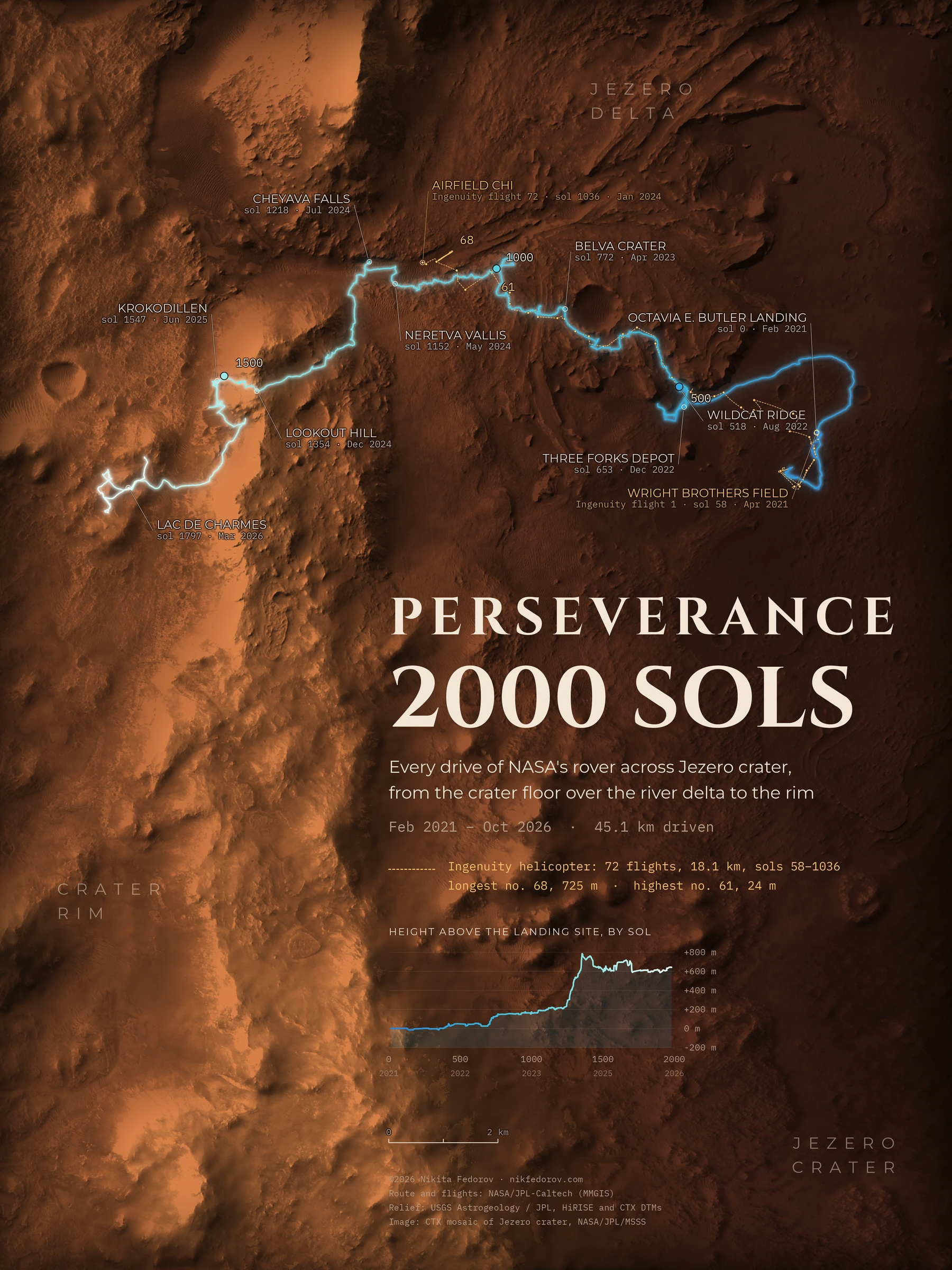
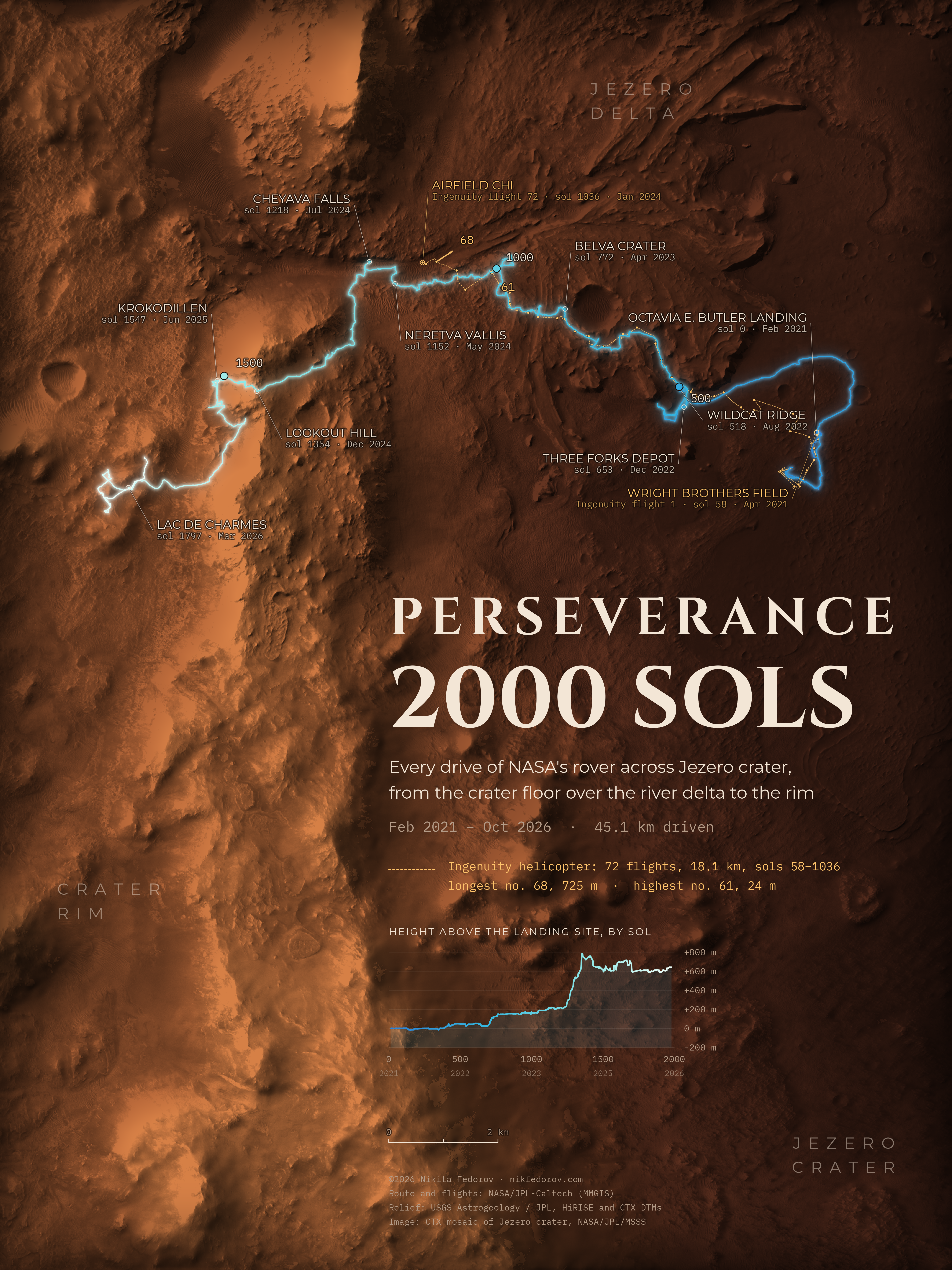
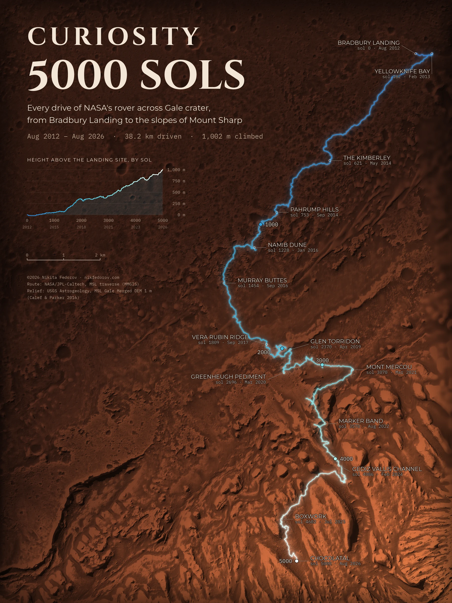
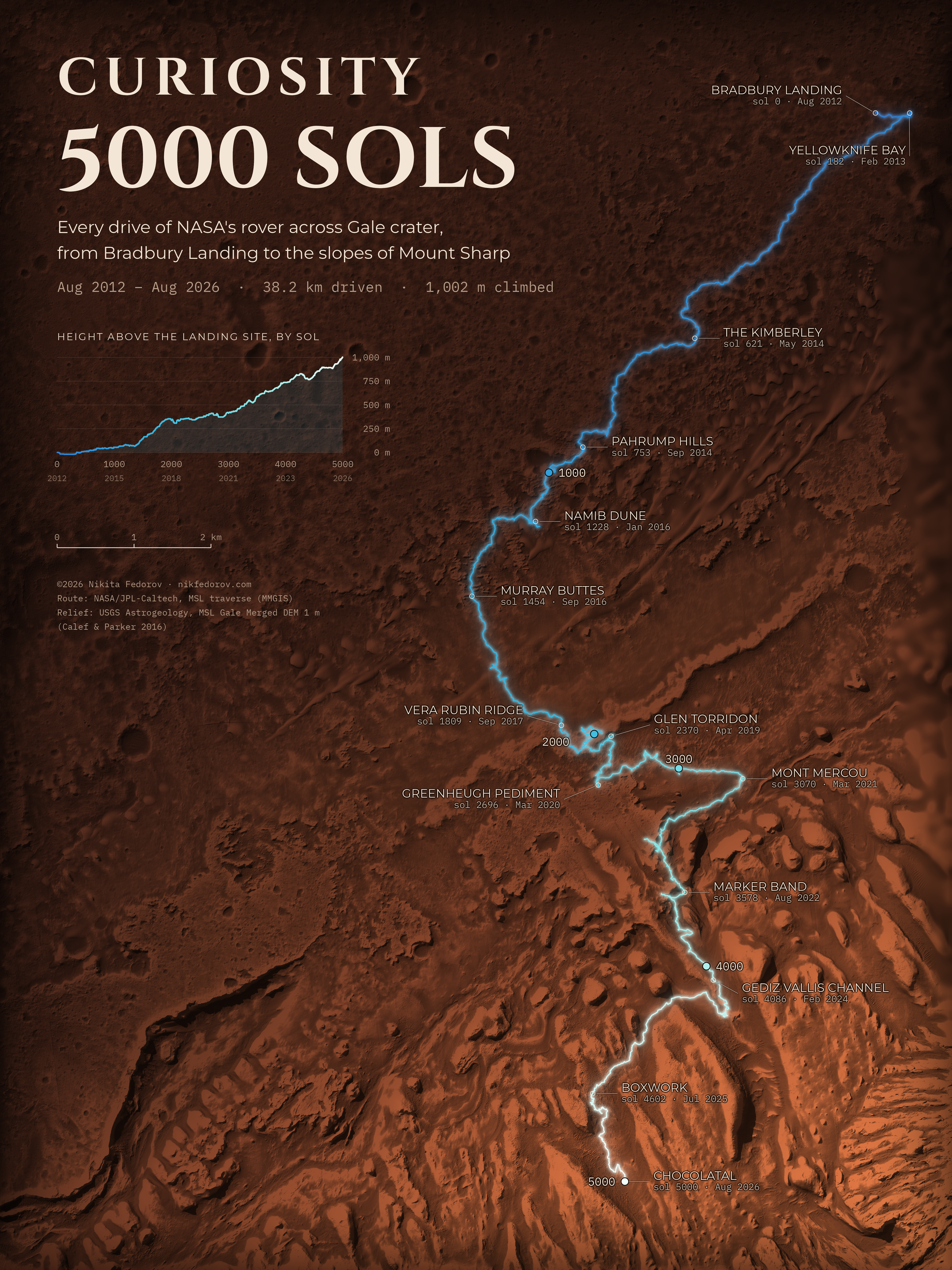
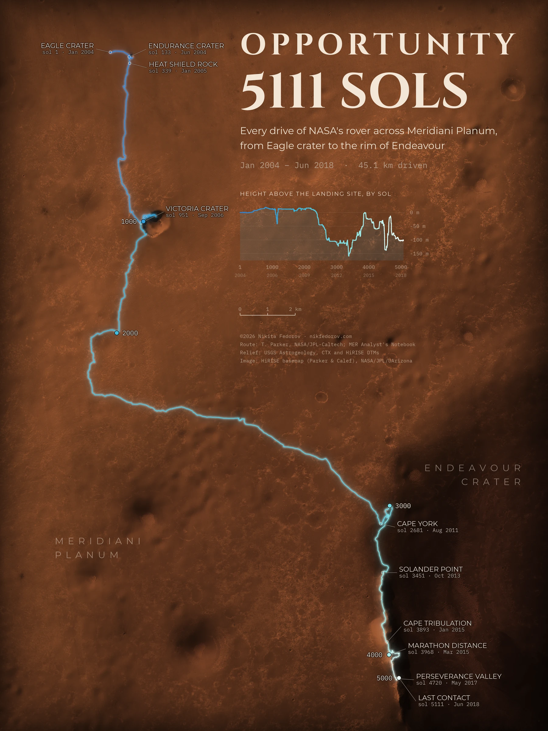
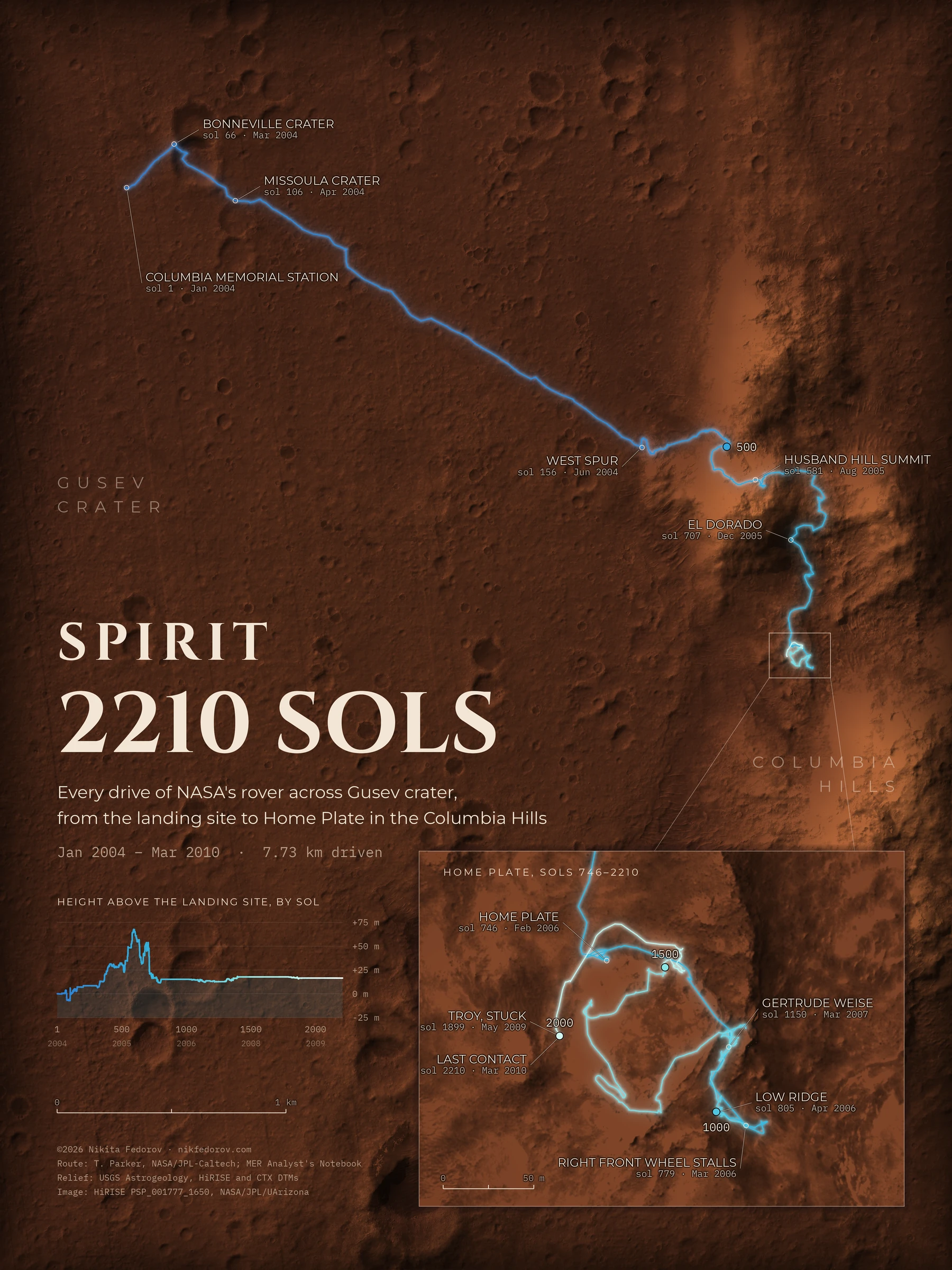
Four NASA rovers, four maps, one way of drawing. Each map follows one rover for as long as it worked, in sols, the Martian days of 24 h 40 min. The route is a single line that glows from blue at the landing site to white at the last sol, with a dot at every thousand sols. A chart gives the height by sol and doubles as the colour key. The relief under the line is real terrain from orbit, so the line shows where the rover went and what it climbed.
This autumn gave a reason to make them: Curiosity reached sol 5000 on 30 August 2026 and Perseverance reached sol 2000 in early October. The other two are the rovers that came before, and they ran for much longer than planned.
Perseverance landed in Jezero crater on 18 February 2021. In 2000 sols it drove 45.1 km: across the crater floor, up the front of an ancient river delta, along the channel of Neretva Vallis to the rock Cheyava Falls, and over the crater rim. The amber dashes are the 72 flights of the helicopter Ingenuity, 18.1 km in all, from Wright Brothers Field to Airfield Chi. It was built for five. That is as far as Opportunity drove in its whole life, in about 2.5 times fewer sols.
Curiosity landed in Gale crater on 6 August 2012 and has been climbing Mount Sharp ever since. By sol 5000 it had driven 38.2 km and climbed 1002 m from the landing site. The last place on the map is the sand ridge Chocolatal, where NASA took a postcard for the 5000th sol.
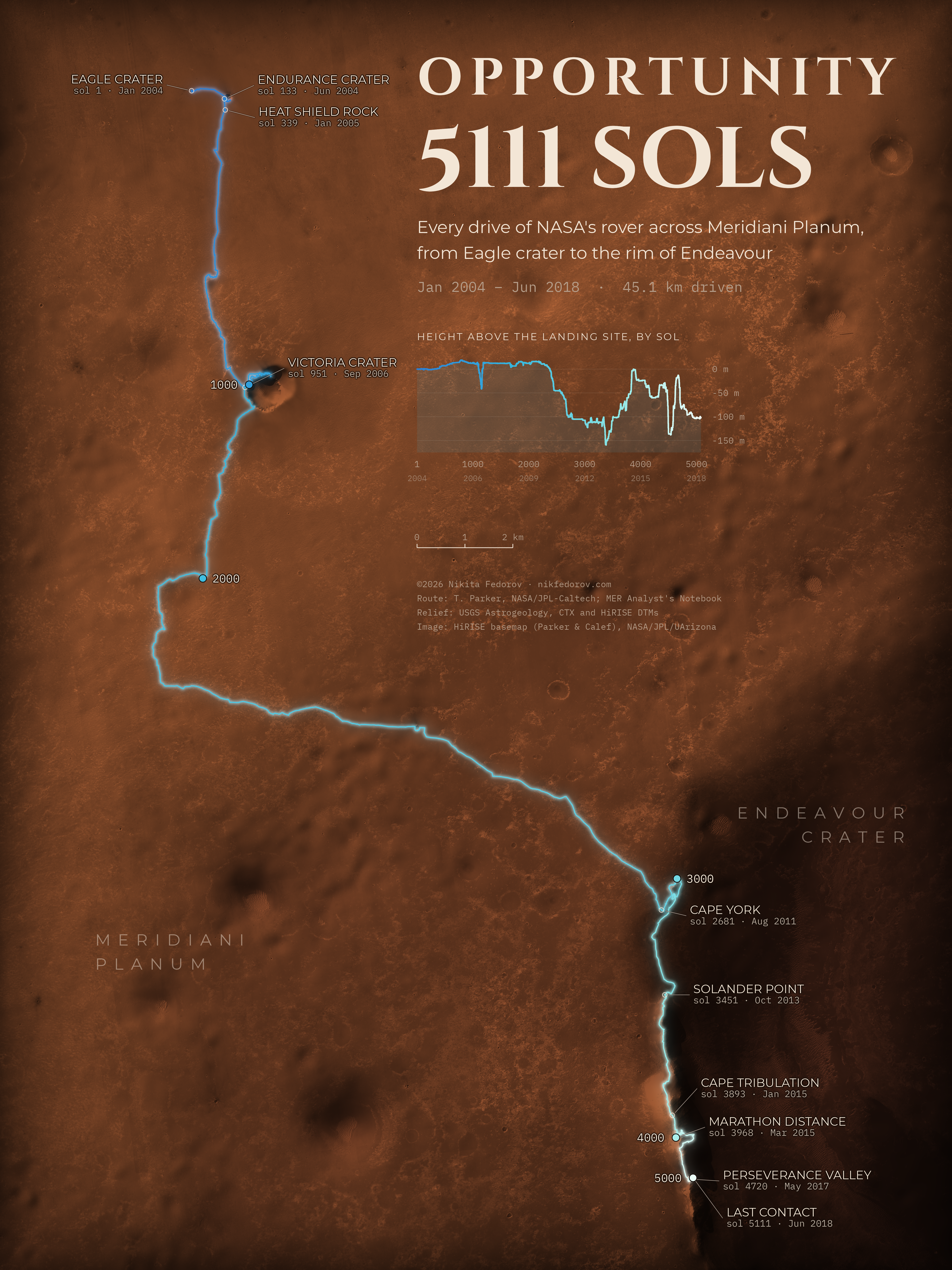
Opportunity landed in Eagle crater on 25 January 2004, for a mission planned to last 90 sols. It worked for 5111 and drove 45.1 km: south past Endurance and Victoria craters, then east-southeast to the rim of Endeavour and along it to Perseverance Valley. The plain is so flat that the surface is drawn from a 25 cm HiRISE photo. The last signal came on 10 June 2018, during a planet-wide dust storm.
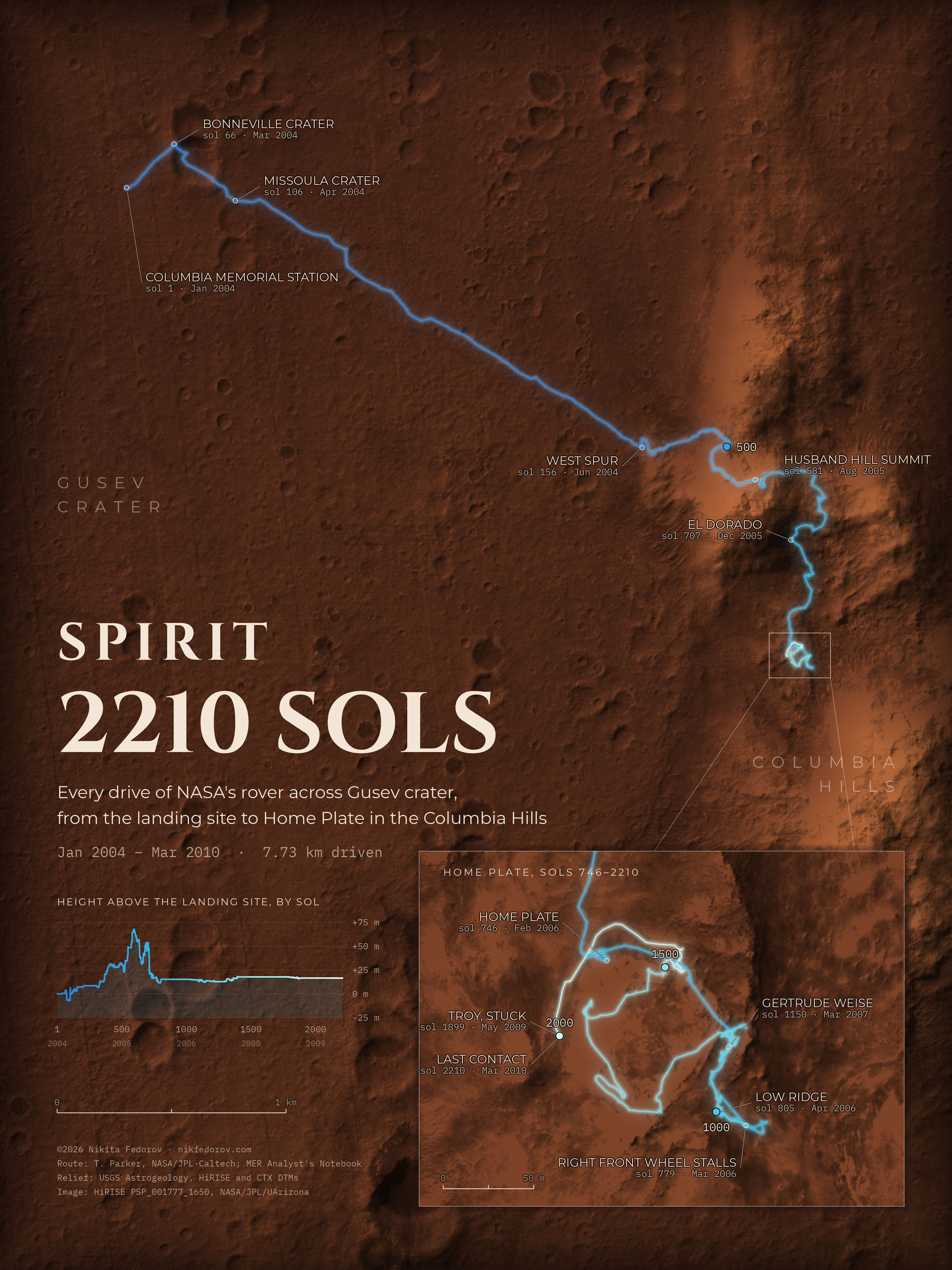
Spirit landed in Gusev crater on 4 January 2004, three weeks before Opportunity, also for 90 sols. It drove 7.73 km: to Bonneville crater, across the plain to the Columbia Hills, over Husband Hill and down to the plateau Home Plate. There it spent its last four years, on a patch 117 by 116 m, shown in an inset seven times larger. It lost a front wheel, found almost pure silica, and got stuck in sand at Troy. The last signal came on 22 March 2010, sol 2210.
The maps are not at one scale: each has its own scale bar, 1 km on Spirit’s and 2 km on the others. Routes and stops are NASA/JPL-Caltech’s “Where are the rovers” maps (Perseverance, Curiosity) and the MER Analyst’s Notebook (Opportunity, Spirit). Relief is from USGS Astrogeology terrain models (HiRISE 1 m, CTX 20 m), and the surface image comes from CTX and HiRISE mosaics. Made in R with rayshader and ragg.
Source: routes, NASA/JPL-Caltech (MMGIS) and T. Parker, MER Analyst’s Notebook; relief, USGS Astrogeology / JPL; images, NASA/JPL/MSSS and NASA/JPL/University of Arizona.